Political divisions
|
|
|

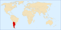
Argentina is composed of twenty-three provinces and one autonomous city, Buenos Aires. The administrative divisions of the Provinces are the departments, and the municipalities, except for Buenos Aires Province, which is divided into partidos.
The City of Buenos Aires is divided into communes. The provinces are organized as a federation, each one with a local constitution.
They hold all the power that is not specifically delegated to the national government.
During the Argentine War of Independence the main cities and their surrounding countrysides became provinces, though the intervention of their cabildos. The anarchy of the year XX completed this process, shaping the original thirteen provinces. Jujuy seceded from Salta in 1834, and the thirteen provinces became fourteen.
After seceding for a decade, Buenos Aires accepted the Constitution of Argentina of 1853 in 1860. Buenos Aires was made a federal territory in 1880.
A 1862 law determined that the territories under control of Argentina but outside the frontiers of the provinces would be called national territories. This allowed in 1884 to establish the governorates of Misiones, Formosa, Chaco, La Pampa, Neuquén, Río Negro, Chubut, Santa Cruz and Tierra del Fuego.
The agreement about a frontier dispute with Chile in 1900 created the national territory of Los Andes, whose territories were incorporated into Jujuy, Salta and Catamarca in 1943.
La Pampa and Chaco became provinces in 1951. Misiones did so in 1953, and Formosa, Neuquén, Río Negro, Chubut and Santa Cruz in 1955. The last national territory, Tierra del Fuego, became a province in 1990.


