
National Park Los Alerces
|
|
|


It was created in 1937 and it has a surface of 263,000 has. The foundation of its creation is the protection of the forests of lahuán or larch, one of the trees of greater longevity of the planet, that got to be in extinction danger
The atmospheres of the protected area can be fitted in the echo-regions of patagónico forest and of stops You walk, is to say a cold tempered climate, with great estacionalidad.Los to invier to us are rainy and with snowed, the dry summers, with fresh nights. In the area is a complex lacustrine system of numerous rivers, water streams and mirrors.
The Argentine Patagonia has the older and dense wooded privilege to have one of the formation of this ancestral species, still considered sagrada by the indigenous populations.
To the flanks of the Menéndez lake, the majestic units have a considered age of 4,000 years and reach 70 meters of height and 3 of diameter. the Arrayanes River the Arrayanes River Towards the east, the transition with the steppe marks less leafy forests where they grow maitén and the cordillerano cypress. Also the radales, arrayanes, ñires, lengas and maquis cover mountains and conform a landscape of incredible beauty clarified by rivers and lakes.


The exotic flora, brought by the European settlers, represents in this National Park a serious problem to conserve the native vegetation. The mosqueta rose, the lupino and the daisy, among other plants, began to disperse without aid by the edges and clear of the forest, moving to the original ones Also, the illegal wood operation and fires they prevent the recovery of the different arboreal species that are of slow growth and take in covering slopes, favoring the erosion.

Therefore also in this protected area a system of boundaries of hunting with limited extraction is allowed. The mink was introduced between years 1945 and 1960 to supply to the market of skins local, mainly in Cholila, locality located to the northwest of the National Park.
In the decade of ` 70, several were released and they were multiplied, dispersing by all the Andean region of Chubut and Ri'o Negro. Of carnivorous habits, the mink attacks young and adults of birds and terrestrial or aquatic mammals, threatening the native fauna. Equally, the pudú is attacked by the asilvestrados dogs. The furtive hunting puts as much in danger to huemul as to puma, both appraised exemplary for the hunters.
More ago than 3,000 years, the first natives who settled in the region were hunting-recolectores groups that occupied the valley of the Desaguadero river.
With bones of animals and stones they made boleadoras, ends of arrow, striker pins to sew leathers and devices of milling. In the walls of his eaves they made cave paintings with geometric reasons, labyrinths and schematic human figures, very similar to the found ones in the northwest of the Patagonia.
Their descendants were the araucanos groups tehuelches and, that modified several of their attitudes and ways of life after the arrival of the Spaniards. Its main incorporation was the horse, that produced great transformations, among them the greater mobility of the groups.
The Campaign of the Desert (1879-1883) finished with the disarticulation of the indigenous populations. At the present time, families exist mapuches who live in the zones bordering to the Park.
Numerous rivers, lakes and lagoons, cascades, and glaciers to high altitude exist.
The park counts on a set of 9 lakes like the Futalaufquén, Menéndez, Rivadavia, Krügger, Green, Swan, Stange, Chico and Amutui Quimei, being a this last dam originated by the Futaleufú prey, some of these lakes are connected by diverse Futalaufquen Lake Futalaufquen Lake rivers until arriving at a the dam, where this I complete gives the birth of several rivers.
The important torrent but, laughed Futaleufú, ends finally after crossing the border in in the Pacific Ocean.

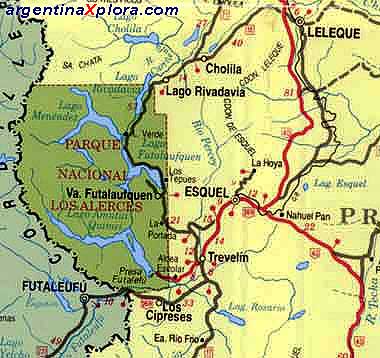
In order to accede to the National Park it is necessary to go to the city of Esquel. From there, by the National Route Nº 259 joining with the Provincial Route Nº 71 that crosses the area protected in direction the north-south. By this way it is arrived at Villa Futalaufquen, where the administrative center of the National Park is located.
The Route continues towards the north of the Park uniting Villa Futalaufquen with the National Route Nº 258, course to the City of the Handbag.
The city of Esquel has an airport (to 38 km of the National Park) and a terminal of omnibus, which offers greater possibilities from access to the protected area.